


On Monday June 5th, Pascal Smet, the secretary of state for Urban Planning announced that Urban.brussels has granted a planning permit to De Werkvennootschap for the development of the tram line in Avenue du Bourget from the NATO roundabout to the border with Flanders. The permit for the creation of a pedestrian-cyclist infrastructure linking the turn on Rue de la Fusée was also granted.
The permit marks the Brussels Region’s determination to move forward hand in hand with the Flemish Region to connect the center of Brussels from the Gare du Nord station and the national airport at Zaventem. It also aims to further transform this city gateway into an urban boulevard with a high landscape dimension, offering a new opportunity for rapid, sustainable travel to and from the capital for all individuals, locals and tourists alike.
This beautiful project is a real win-win for Flanders and Brussels.
Pascal Smet, Secretary of State for Urban Planning

The permission has been granted for the section within the Brussels-Capital Region. It covers the 400 meters between NATO and the regional border. Although this permit only covers a short distance of the 12-kilometre extension of the Bourget-Airport line, it nevertheless marks an important milestone in the realization of this ambitious inter-regional project.
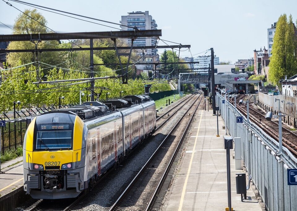
The Luchthaventram, as the project is known, will provide additional means of public transport to the airport and to Brussels. With its 6 new stops, the Luchthaventram will give a wide public access to the residential and business areas between the capital and the airport. In addition to connecting thousands of tourists from the airport to the city center, this new public transport service will be particularly useful for the residents of Schaerbeek, Haren and Evere, and for the many Brussels residents who work in Evere, Diegem and Zaventem.
“With more than 19 million passengers in 2022, Brussels Airport is the gateway to Brussels for many visitors,” Pascal Smet said, as quoted by Belga news agency. “It is also an economically important area that provides jobs for many Brussels residents.”
The project aims to redesign the landscape. Commuters will be encouraged to switch from the car to public transport and cycling. This modal shift will reduce the pressure of automobile traffic in surrounding areas such as Diegem, Evere and Schaerbeek, and substantially improve the quality of life in many neighborhoods in Brussels and the Flemish municipalities bordering this airport and economic zone.

“Connecting Brussels and its airport via a high-frequency, exclusive right-of-way streetcar capable of handling large numbers of passengers is a strategic objective of the Brussels government,” said Smet. “This project is fully in line with our regional vision of peaceful, multimodal mobility, and with the ongoing transformation of this city gateway into an urban boulevard, where new cycling infrastructure will be added. This beautiful project is a real win-win for Flanders and Brussels in terms of mobility, quality of public space and employment.”
The new infrastructure will make the area more pleasant for cyclists, pedestrians and joggers, as numerous additional cycle paths and footpaths will be created. The vegetation along the line will also be enhanced by plantings that will embellish the public space.


