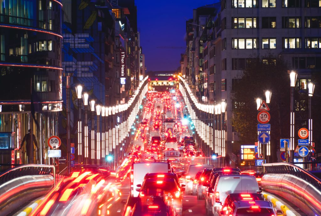


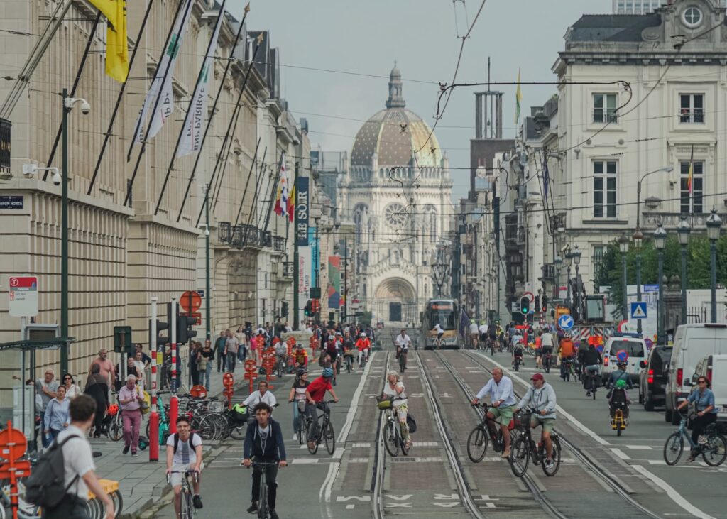
On Thursday February 17th, the City of Brussels (Ville de Bruxelles) announced plans to reduce traffic in the city center from August 16th. The plan, which will be presented to the city council on Monday, aims to reduce transit traffic in the busy and residential areas of the city center and give more space to pedestrians, cyclists and public transport.
The project is in line with the regional Good Move Mobility Plan, which is based on a subdivision in neighborhoods. With this new traffic plan, the City of Brussels is contributing to the creation of a zone with less cars in the center of the city, as was recently announced by the municipalities of Schaerbeek and Anderlecht for their first neighborhood meshes.
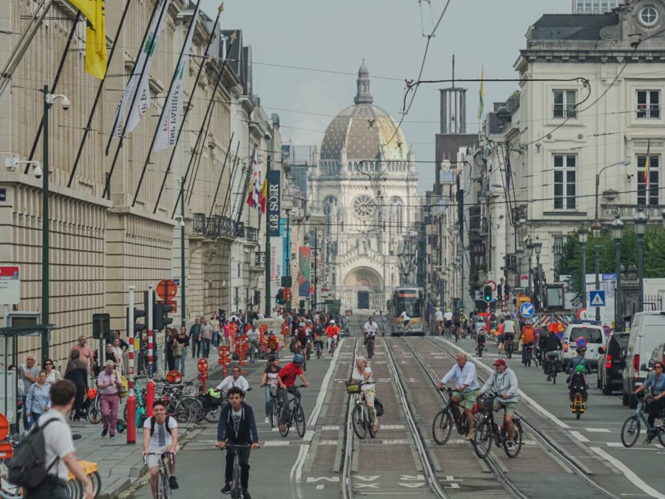
With the new traffic scheme, we are giving the city back to the people who want to be there, to those who make it their destination or their starting point.
Bart Dhondt, Mobility alderman

On the scale of the Brussels Region, which supports the municipalities concerned, the mesh operation will extend over ten years. In the EU quarter, the pedestrian walkway on the central boulevards acts as a sort of backbone for the future calmed zone. Overall, outside of it, all modes of transportation will remain possible, but through traffic will be made very complicated. Motorized traffic will be systematically directed towards the small ring according to the principle of traffic loops, using one-way traffic and filtering (access reserved for residents, merchants, etc.).
For cyclists, the circulation from the north to the south of the EU quarter will be improved via the creation of a bicycle street between Van Artevelde and Laeken streets. Through its new traffic scheme, the City of Brussels is also tackling twelve Accident Concentration Zones, to make the EU quarter much safer for pedestrians: Porte de Flandre and Place de l’Yser intersections; Pletinckx-Van Artevelde and Dansaert-Van Artevelde; Rue des Cendres-Petite Ceinture and Rue du Marais-Petite Ceinture; Rue Royale-Rue de la Loi; Rue de la Régence-Rue Bodenbroek; or Stalingrad-Boulevard du Midi.
Visitors who travel by car will be directed to the nearest public parking lot. In addition to the new parking regulations, the number of vehicles looking for a parking space will also be reduced, creating a smoother and safer traffic flow. A series of measures have already been implemented over the past few months in order to achieve this calming of the city center.
A number of other measures are planned to make the city center more accessible: adaptation of the remote ticketing system for public parking lots in collaboration with the Region; new streetcar lines linking Rogier to Neder-Over-Heembeek and Belgica to the Central Station; a new metro line 3, linking the city center to the North and South of the Region; and the redevelopment of the Adolphe Max boulevard, Saint Catherine Street and the streets around the new Brucity administrative center.
According to Politico, some residents are not pleased with the plans proposed. Some shop owners and managers fear the change could affect the sales of all local businesses because many clients drive into the city center.


