After weeks of seismic activity, a volcano has finally erupted in Iceland’s southern Reykjanes Peninsula on Monday night.
A state of emergency has been in place since 11 November as authorities braced for the eruption. Around 4,000 residents were already evacuated from the area in November as a precautionary measure, so no people were near the eruption when it occurred.
1. Eruption
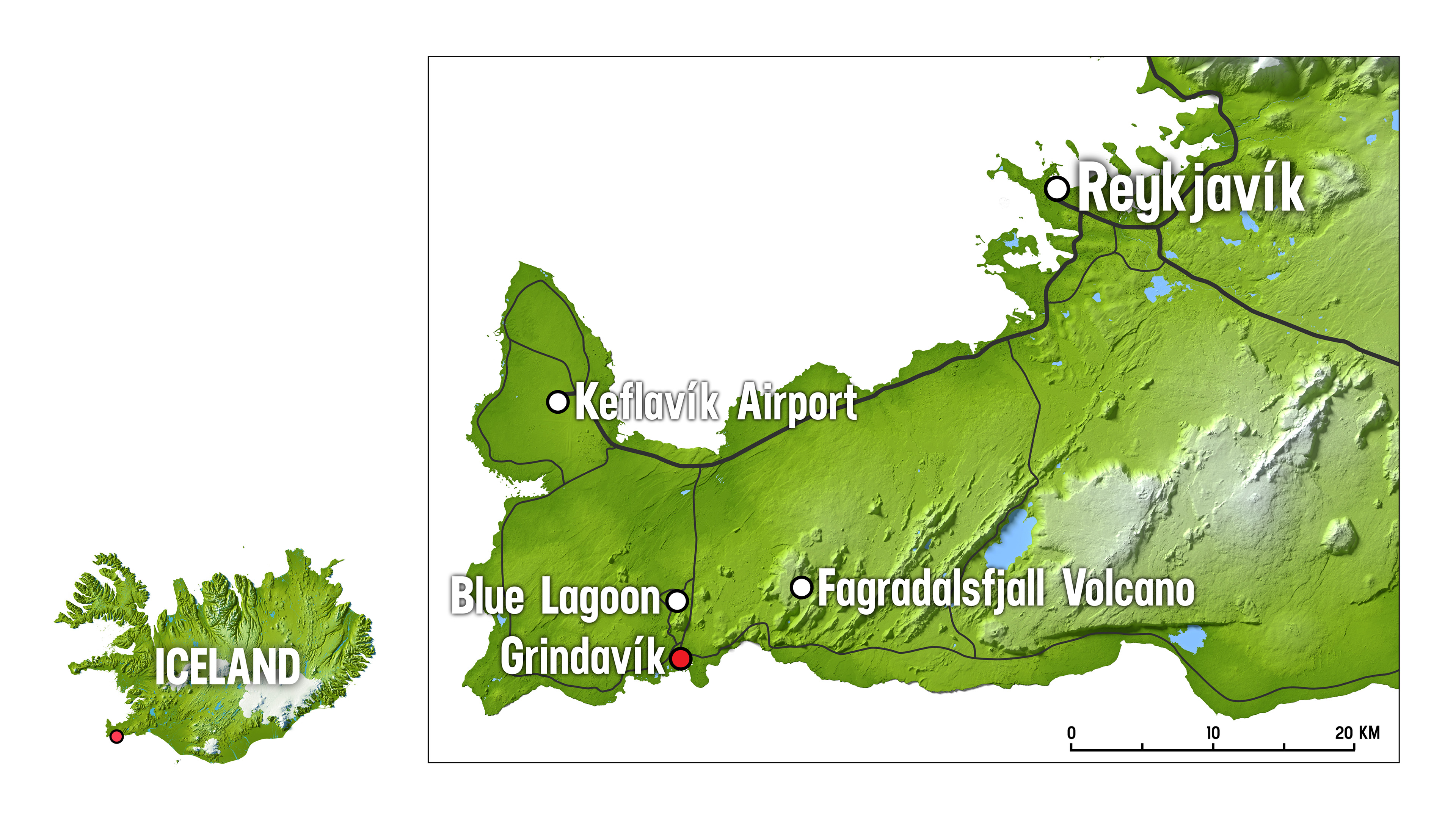
According to the Icelandic Met Office (IMO), the eruption started at 10:17 pm local time on Monday, beginning north of the town of Grindavík, which houses the famous Blue Lagoon geothermal spa. The eruption was preceded by an earthquake swarm that started at 9 pm. Located close to Sundhnúkagígar, the eruption fissure kept expanding.

The rate of lava discharge during the first two hours of the eruption was thought to be on a scale of hundreds of cubic metres per second, with the largest lava fountains on the northern end of the fissures. Lava continues to spread laterally from either side of the newly opened fissures, according to IMO, with significant ground deformation already being visible on real-time GPS measurements only 4 hours after the eruption started.
Unlike milder eruptions that occur in Iceland where visiting the site is possible and sometimes creates tourism attractions, like the new baby volcano appearing this summer in the same peninsula, authorities have warned that this is not a tourist attraction and people should stay away from the site.
2. Stabilising
At 3 am Tuesday morning, IMO announced that the intensity of the eruption was decreasing, but warned that the decreasing intensity is not an indication of how long the eruption would last, rather only that the eruption is reaching a “state of equilibrium”. This development has been observed at the beginning of all eruptions on the Reykjanes Peninsula in recent years, according to IMO, which continues to closely monitor the situation.
The fissure ultimately reached a length of 4 kilometres, according to the latest IMO update, with the northern end just east of Stóra-Skógfell and the southern end just east of Sundhnúk. The distance from the southern end to the edge of Grindavík is almost 3 km. However, “although the eruption is for now in a safe distance from Grindavík, the long fissure with burning lava is geologically in potentially the most dangerous location”, former Icelandic President Ólafur Ragnar Grímsson shared on X.
3. Impact on aviation
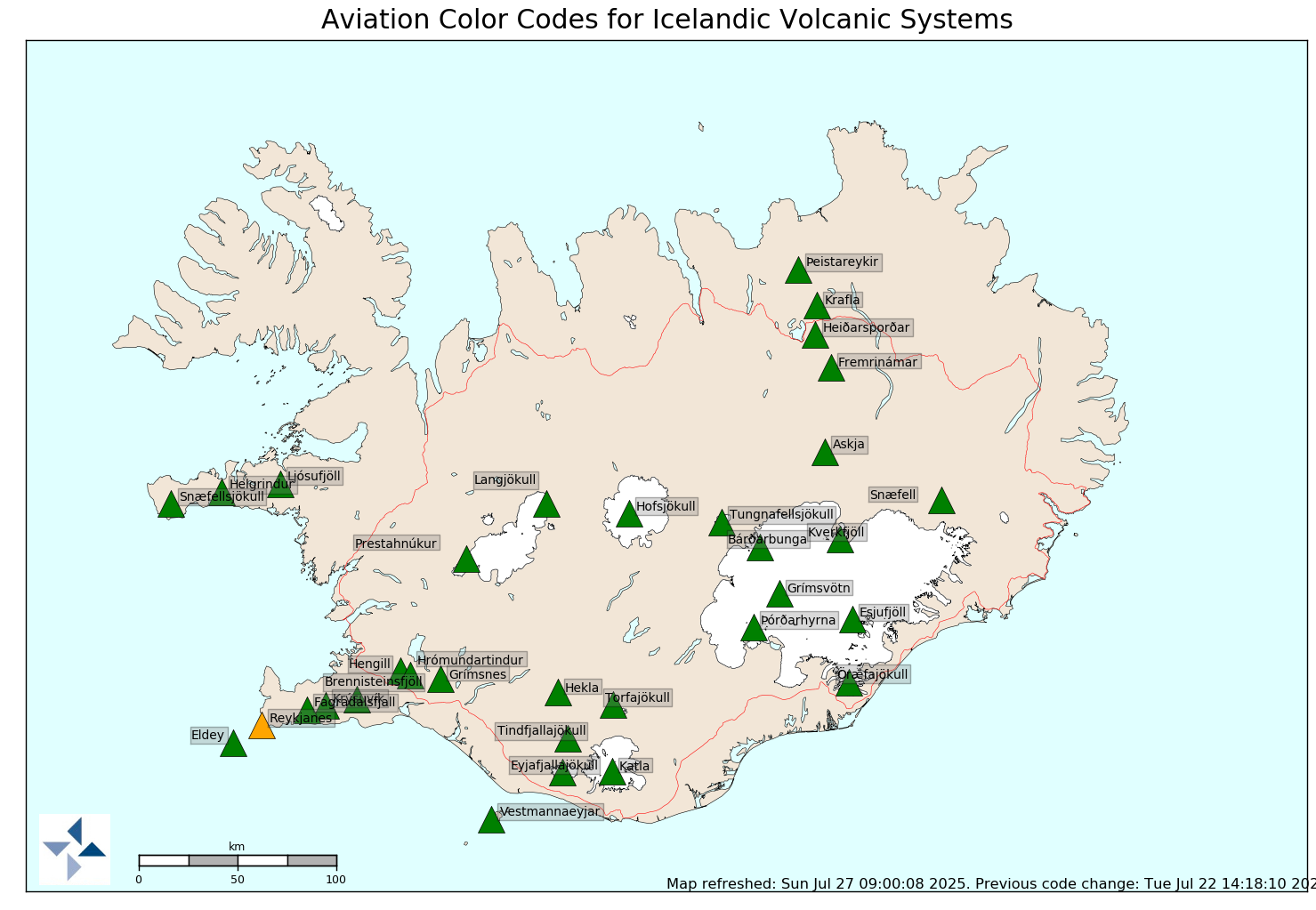
The country’s aviation threat level was raised to orange just for the Reykjanes Peninsula in November and remains at the same level. Orange corresponds to either a volcano exhibiting heightened unrest with increased likelihood of eruption, which has been the case until now, or to a volcanic eruption that is underway, but with no or minor ash emission, which is now the case.

The nearby Keflavik International Airport, Iceland’s largest, continues to operate as normal, reporting no cancellations or significant delays, despite being only 20 km north of the eruption site. However, the road from Grindavík to the airport, as well as all the roads around the town, remain closed while the situation is being evaluated.
Volcanic ash released in the atmosphere not only reduces visibility, but also interferes with flight control systems and aircraft engines, causing them to fail. In April 2010, the Eyjafjallajokull volcano eruption in Iceland brough air travel between Europe and North America to an almost complete standstill for 8 days, causing the cancellation of over 100,000 flights.
However, scientists point out that the circumstances of the two eruptions are different and while the current one is significant, it is unlikely to create major ash plumes. “While the possibility of air traffic disturbance cannot be entirely ruled out, scientists consider it an unlikely scenario”, the country’s Civil Protection Department said in a statement.


